Camping in the Central Sierras
Areas to Camp
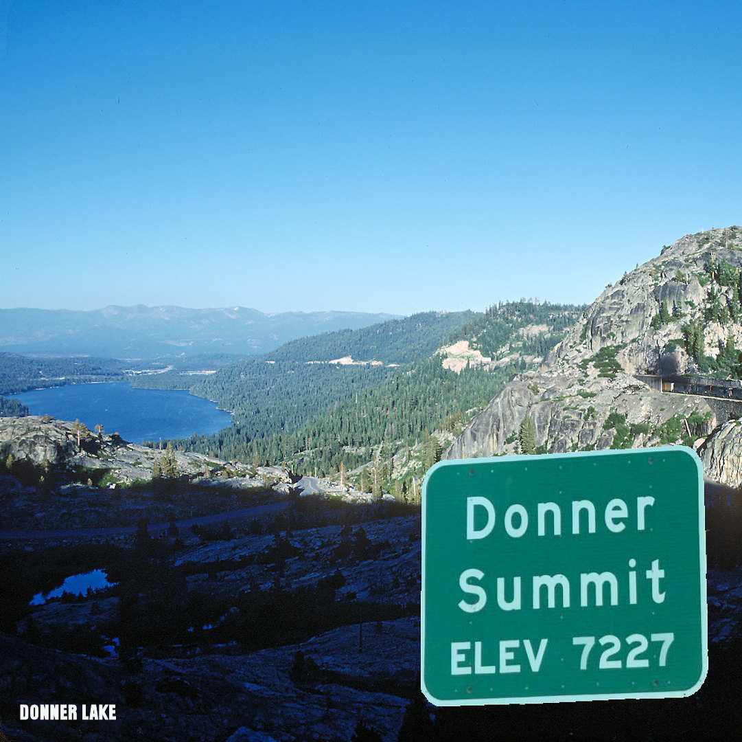
Donner Pass Area/Tahoe NF
Donner Pass is a mountain pass in the northern Sierra Nevada, located above Donner Lake about nine miles west of Truckee, California. It has a steep approach from the east and a gradual approach from the west. The pass has been used by the California Trail, First Transcontinental Railroad, Overland Route, Lincoln Highway and Interstate 80. The pass is named after the Donner Party, a group of settlers who were trapped by snow in the winter of 1846-47 and resorted to cannibalism to survive. Today, the area is a popular destination for recreation, with several ski resorts, hiking trails, and scenic views.
Some related links are:
This is a website that describes the history, location, and attractions of Donner Pass .
Donner Memorial State Park is a state park of California, US, preserving the site of the Donner Camp, where members of the ill-fated Donner Party were trapped by weather during the winter of 1846–1847.
Camping, Boating, Hiking, Fishing, Skiing, Lodging, Resorts, and More!
Forest Service- Tahoe NF website

Crystal Basin Recreation Area/Eldorado NF
Crystal Basin is a recreation area in the Eldorado National Forest in California. It covers about 85,000 acres of evergreen forests, lakes, reservoirs, and streams. It is a popular destination for camping, hiking the many trails, boating and fishing on the many lakes and streams and wildlife viewing and off roading on the Rubicon Jeep Trail.
Some related links are:
This is a website that describes the history, location, and attractions of Crystal Basin and the nearby town of Goldfield. It also has some photos of the rocks and the scenery.
This is a website that provides some information about the campgrounds, roads, and trails in Crystal Basin. It also has some links to other activities and attractions in the area.
This is a website that gives an overview of the geology, ecology, and history of Crystal Basin. It also has some maps and directions to the area.
"Our vision is to be the trusted stewards of the Rubicon Trail, ensuring sustainability for the experience of the users".
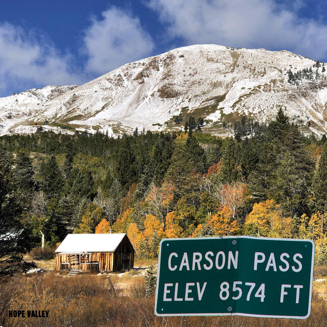
Carson Pass Area/Eldorado NF
Carson Pass is a mountain pass on the crest of the central Sierra Nevada, in the Eldorado National Forest and Alpine County, eastern California. The pass is traversed by California State Route 88, and lies on the Great Basin Divide. It is a historic and scenic route that offers many recreational opportunities, such as hiking on the Pacific Crest Trail, camping in Blue Lakes Area, fishing in Caples or Silver Lakes, skiing at Kirkwood Ski Area, and Cross-Country Skiing and Snowshoeing in the Backcountry.
Some related links are:
The Carson Trail, which was one of the main routes for the California Gold Rush immigrants. You can see a plaque that commemorates Kit Carson, who carved his name on a tree near the pass in 1844
On the shores of Silver Lake. Food, Lodging, fishing, hiking, boating and more.
The Eldorado National Forest Interpretive Association (ENFIA) is a nonprofit organization that is dedicated to helping the Eldorado National Forest serve the public.
"Up and Over Carson Pass" Current Road Conditions and more.
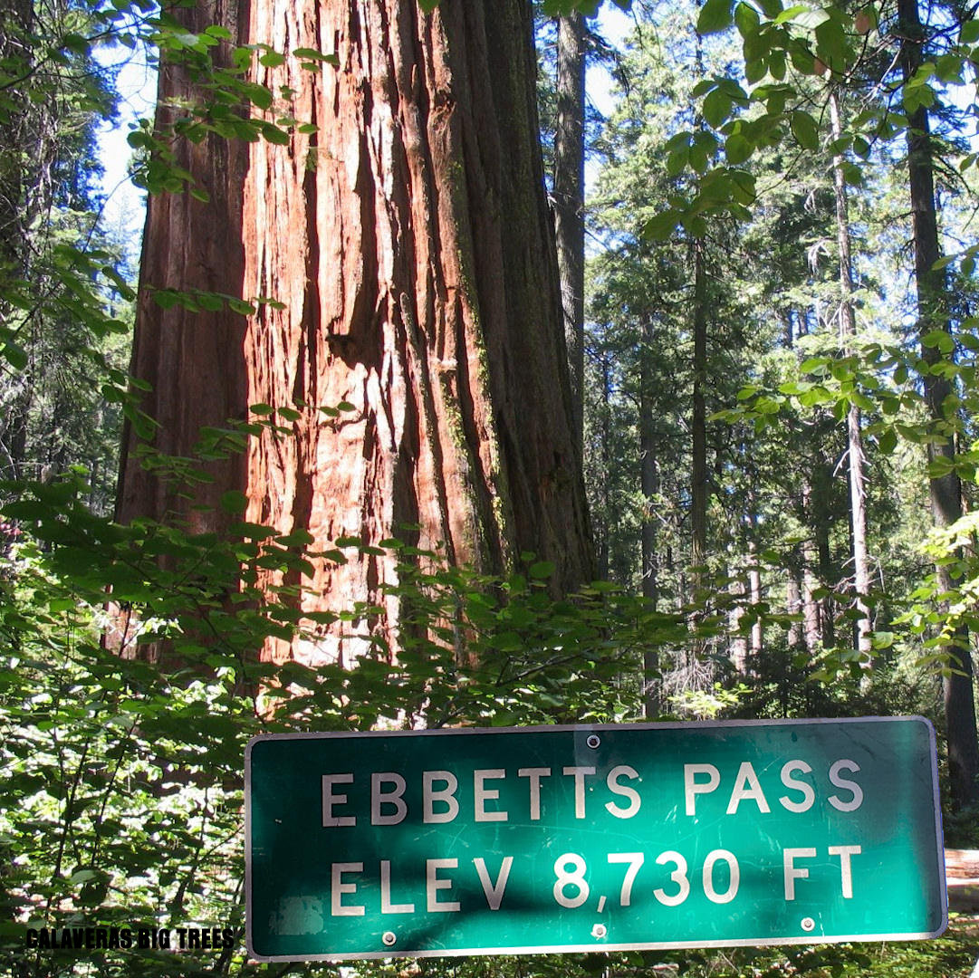
Ebbetts Pass Area/Eldorado & Humboldt-Toiyabe NF
Ebbetts Pass is a high mountain pass in the Sierra Nevada range in California. It is named after John Ebbetts, who claimed to have crossed the pass in 1851. It is also a California Historical Landmark and a National Scenic Byway.
Some related links are:
The pass connects the communities of Arnold to the west and Markleeville to the east. It is a historic and scenic route that offers many recreational opportunities, such as hiking in the Mokelumne Wilderness, camping at Lake Alpine, fishing in the Stanislaus and Mokelumne Rivers, skiing at Bear Valley Ski Resort. The pass is open to vehicles in summer only, as it closes during winter due to snow accumulation.
U.S. Forest Service, Ebbetts Pass
National Scenic Byway Foundation
Current Road Conditions and more!
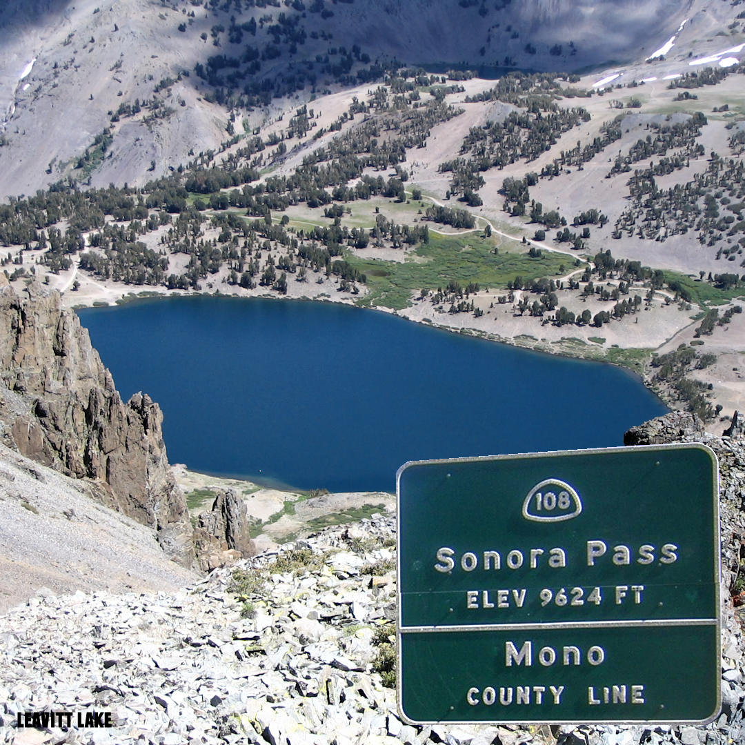
Sonora Pass Area/Stanislaus & Humboldt-Toiyabe NF
Sonora Pass is a mountain pass in the Sierra Nevada in California. It is the second-highest pass with a road in California and in the Sierra Nevada. It is 321 feet (98 m) lower than Tioga Pass to the south. State Route 108 traverses the pass, as does the Pacific Crest Trail1
Some related links are:
The pass connects the communities of Sonora to the west and Bridgeport to the east. It is a historic and scenic route that offers many recreational opportunities, such as hiking in the Emigrant Basin, camping at Pinecrest Lake, fishing in the Stanislaus and Tuolumne Rivers, skiing at Dodge Ridge. The pass is open to vehicles in summer only, as it closes during winter due to snow accumulation.
Lots of information about the Sonora Pass area.
Food and Lodging and Horse Packing into the Emigrant Wilderness, Carson Iceberg Wilderness, or northern Yosemite National Park.
The CalTrans website for Road Conditions on the Sierra Nevada Mountain Passes
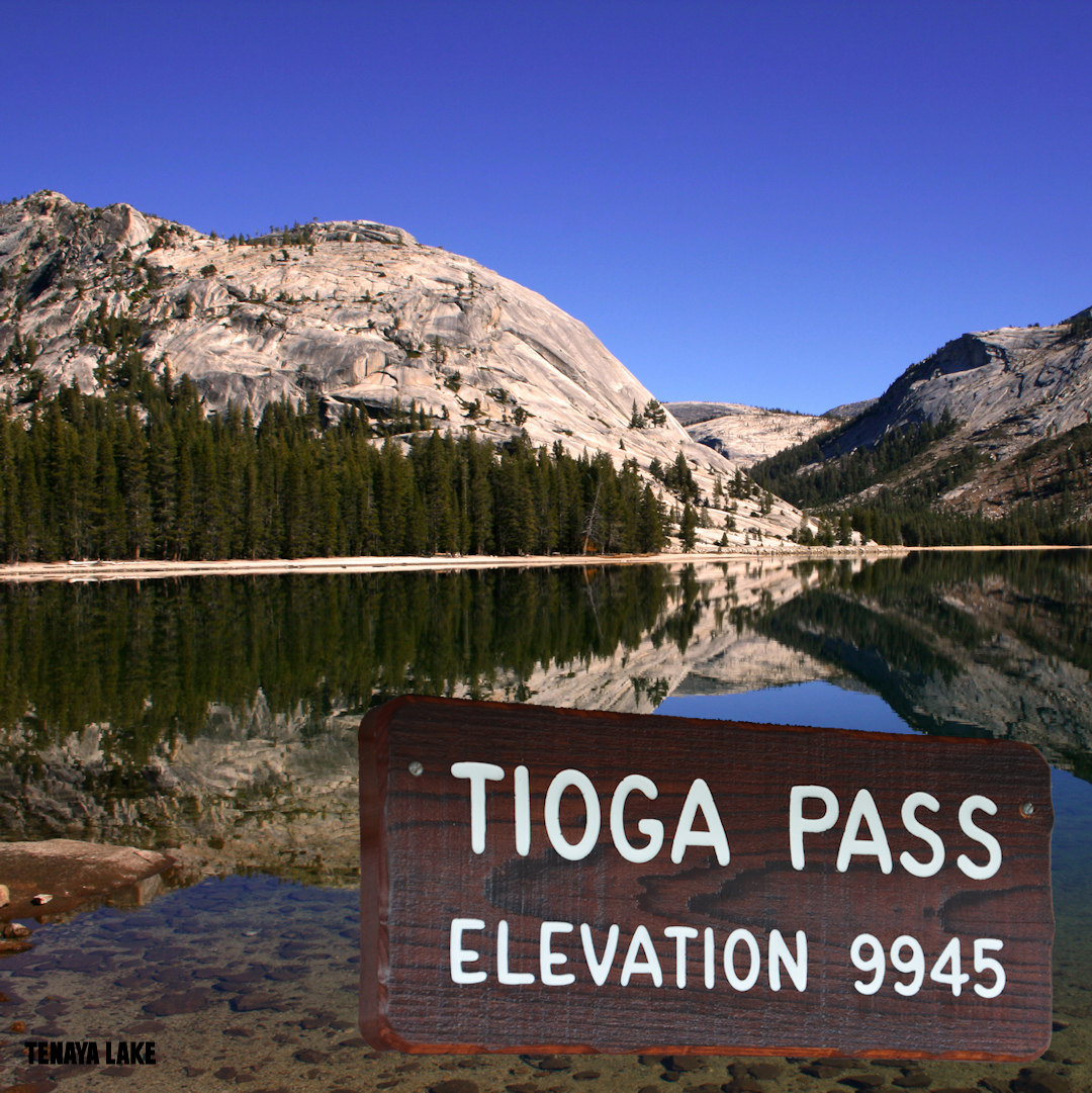
Tioga Pass Area/Yosemite NP
Tioga Pass is a mountain pass in the Sierra Nevada mountain range of California. State Route 120 runs through it, and serves as the eastern entry point for Yosemite National Park, at the Tioga Pass Entrance Station. It is the highest elevation highway pass in California and in the Sierra Nevada at an elevation of 9,945 ft (3,031 m).[1][2] Mount Dana is to the east of the pass, and Gaylor Peak to the west.
Some related links are:
This pass, like many other passes in the Sierra Nevada, has a gradual approach from the west and drops off to the east dramatically, losing more than 3,000 ft (910 m) by the time the road reaches U.S. Route 395. The pass is subject to winter closure due to high snowfall, normally from around the end of October until the end of May the following year.
The National Park Service Yosemite Website
Badger Pass Ski Area/TravelYosemite.com
The Yosemite.com/Maraposa County Website
Links
USGS Topo Maps- Central Sierra Nevada Mountains